Apple Maps is an indispensable navigation tool for iPhone users, offering real-time directions, detailed route planning, and a host of features to simplify travel. However, its interface, filled with various icons and symbols, can be confusing for new users. This guide breaks down the meanings of these icons, ensuring you make the most of Apple Maps whether you’re commuting, exploring a new city, or planning a road trip.


Understanding Key Apple Maps Icons
Apple Maps utilizes a range of icons to convey specific functionalities or information. Here’s a detailed explanation of the most commonly seen icons:
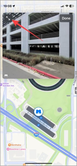
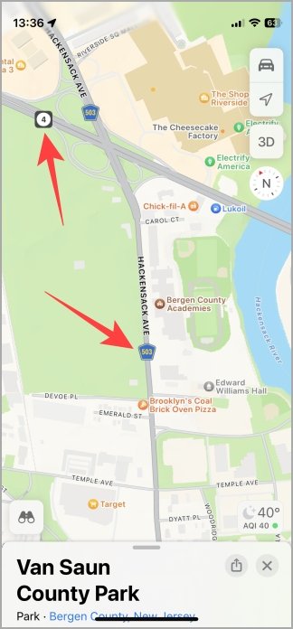
1. Binoculars Icon
- Meaning: Activates the Look Around feature, letting you explore areas at street level with high-resolution imagery.
- Example: Planning a trip to Times Square? Use this to get a virtual street-level preview.
- Tip: Look Around is available in select regions; check if your destination supports it.
2. Double Arrow Icon
- Meaning: Expands the Look Around map to full screen for a more immersive experience.
- Tip: Use this when exploring dense urban environments to identify landmarks more clearly.
3. GPS Icon
- Meaning: Indicates your current location on the map.
- Tip: If the map doesn’t align with your location, tap the GPS icon to recenter it.
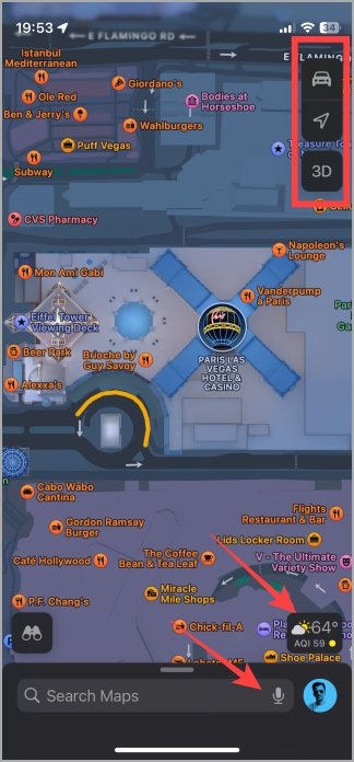
4. Car Icon
- Meaning: Lets you choose between different map types such as Explore, Driving, Transit, or Satellite.
- Tip: Use the Driving view for real-time traffic updates or Satellite view for aerial imagery.
5. Arrow Icon
- Meaning: Re-centers the map to show your current location if you’ve moved the view.

Enhancing Your Map Experience with View Options
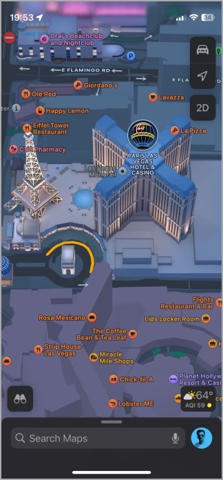
6. 2D/3D Icon
- Meaning: Switch between 2D and 3D views to explore the map more effectively.
- Tip: Use the 3D view in cities like New York or London to visualize tall buildings and landmarks.
7. Sun/Cloud Icon
- Meaning: Displays the weather conditions and Air Quality Index (AQI) for your current location.
- Example: Before heading out, check if your destination has good air quality or sunny skies.
8. Mic Icon
- Meaning: Enables voice search for hands-free navigation.
- Tip: Say commands like “Navigate to the nearest gas station” for a seamless experience.
9. Profile Icon
- Meaning: Accesses your saved locations and preferences in your Apple Maps profile.
10. Location Color Codes
- Meaning: Represent different place types on the map using distinct colors:
- Green: Forests, parks, and nature reserves.
- Yellow: Tourist attractions and landmarks.
- Orange: Restaurants, cafes, and bars.
- Red: Hospitals and clinics.
- Purple: Hotels, motels, and resorts.
- Pink: Cinemas, arts venues, and lounges.
- Light Purple: Places of worship.
- Blue: Water bodies.
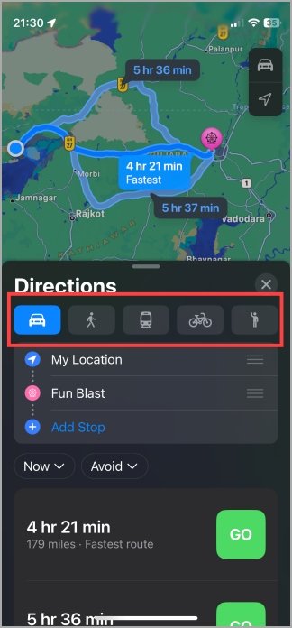
Journey Screen Icons: Real-Time Navigation Assistance
Once you start navigation, Apple Maps displays a different set of icons tailored for your journey.
1. Car Icon
- Meaning: Displays the Estimated Time of Arrival (ETA) for driving.
2. Walking Man Icon
- Meaning: Indicates the ETA for walking routes.
3. Train Icon
- Meaning: Displays the ETA for public transit routes like trains or buses.
4. Cycle Icon
- Meaning: Shows the ETA for cycling trips.
5. Ride-Hailing Icon (Man with One Hand Raised)
- Meaning: Allows you to book a ride through apps like Uber or Lyft.

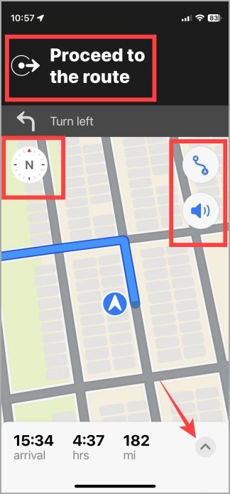
6. Circle with Arrow Icon
- Meaning: Provides turn-by-turn instructions with the distance to your next turn or stop.
7. Compass (N) Icon
- Meaning: Reorients the map to north if you’ve manually rotated it.
8. Zoom In/Out Icon
- Meaning: Adjusts the zoom level for a clearer view of your route.
9. Sound Icon
- Meaning: Adjusts navigation sounds, such as voice prompts for turns or critical updates.
10. Up Arrow (Menu) Icon
- Meaning: Opens a menu with options to add stops, share ETA, or report traffic issues.
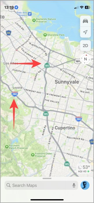
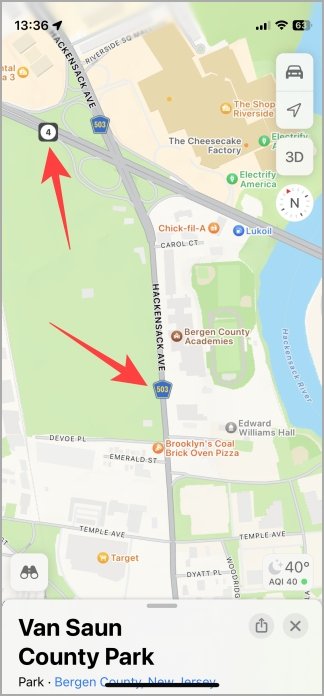
Traffic and Road Symbols: Keeping You Informed
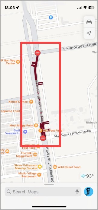
Apple Maps uses specific symbols to provide real-time traffic and road condition updates:
1. Red Circle with White Hyphen
- Meaning: Indicates a road closure.
2. Yellow Exclamation Mark
- Meaning: Signifies a lane closure ahead.
3. Yellow Square with Worker Icon
- Meaning: Denotes road construction in progress.
4. Red Square with Car Icon
- Meaning: Represents an accident on the route.
5. Yellow and Red Lines on the Road
- Meaning: Traffic status indicators:
- Yellow lines: Slow-moving traffic.
- Red lines: Stop-and-go traffic.


Frequently Asked Questions (FAQs)
1. What does the binoculars icon mean on Apple Maps?
The binoculars icon activates the Look Around feature, letting you explore areas at street level.
2. How can I change the map view in Apple Maps?
Use the Car icon to toggle between Explore, Driving, Transit, and Satellite map types.
3. How do I check the weather or AQI on Apple Maps?
Tap the Sun/Cloud icon to see weather conditions and air quality data for your location.
4. What does the red circle with a hyphen symbol mean?
This icon signifies a road closure along your route.
5. Can I add stops or share my ETA in Apple Maps?
Yes, tap the Up Arrow (Menu) icon to access options like adding stops, sharing ETA, or reporting traffic issues.
Conclusion
Apple Maps offers a wealth of features designed to simplify navigation and enhance your travel experience. By understanding its icons and symbols, you can navigate more effectively, avoid potential delays, and make the most of its powerful tools. Whether you’re commuting, exploring a new city, or planning a road trip, mastering Apple Maps will make every journey smoother and more enjoyable.

