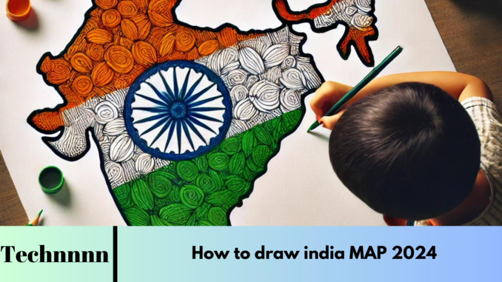
Drawing a map of India can be an engaging way to learn about the country’s diverse geography, from its towering mountains to sprawling plains and intricate coastline. This guide will provide a clear, structured approach to creating an accurate and detailed map of India, whether for a project, art, or personal learning.
Introduction to Drawing India’s Map
India, the seventh-largest country in the world, has a unique kite-like shape and a diverse landscape. Located in South Asia, it is bounded by the Himalayas in the north, fertile plains in the middle, arid deserts in the west, and coastal regions in the south.
Drawing India’s map requires understanding its irregular borders, which encompass 28 states and 8 union territories. Whether you’re a student working on a geography project or an artist capturing the beauty of the nation, this guide will help you create an accurate and visually appealing map.
Step 1: Drawing the Outline of India


1.1 Start with a Vertical Line
- Place a blank sheet of paper on a flat surface.
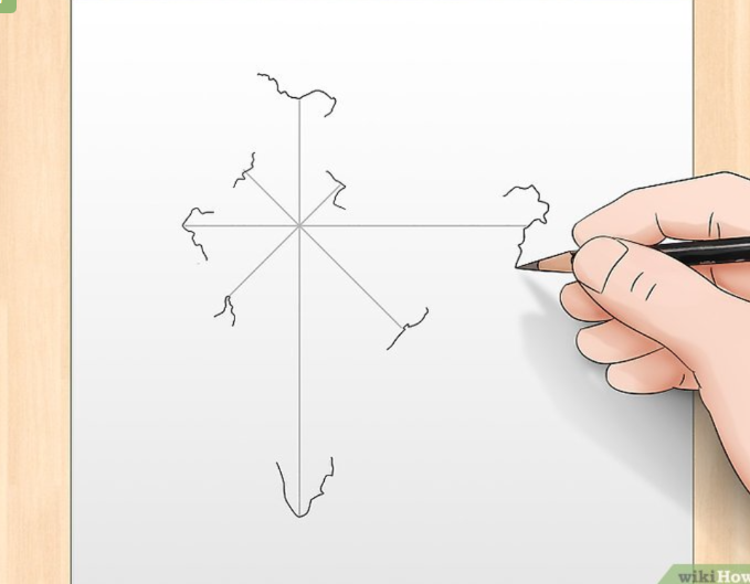
- Using a ruler, draw a vertical line approximately 14.5 cm (5.7 in) long, slightly left of the paper’s center. This serves as the central axis for your map.
1.2 Add a Horizontal Line
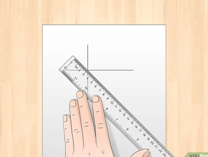
- Measure 4.5 cm (1.8 in) from the top of the vertical line and place a small dot.
- Draw a horizontal line through this dot, extending 4 cm (1.6 in) to the left and 8 cm (3.1 in) to the right.
1.3 Create Diagonal Guidelines
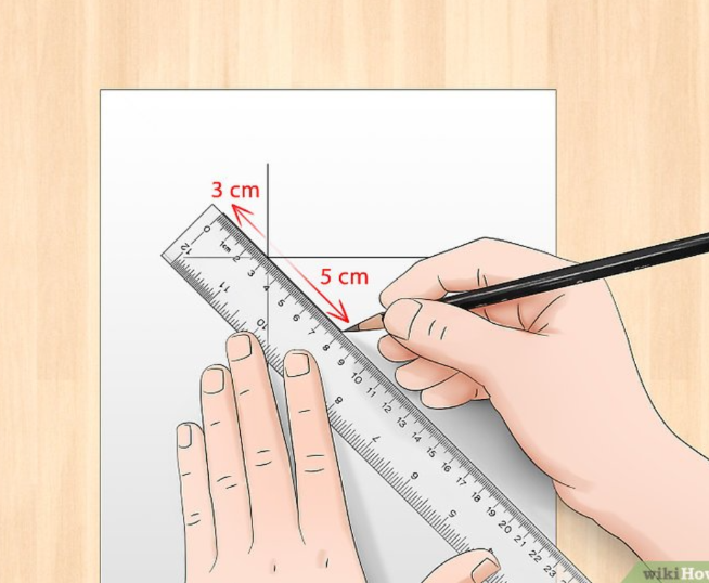
- Position your ruler diagonally to draw an 8 cm (3.1 in) line from the top-left to the bottom-right.
- Repeat for the opposite diagonal, creating a cross-like “X” structure.

1.4 Sketch Curved Edges
- Begin shaping the borders using these guidelines.
- Form the southern tip into a “V,” curve the western coastline like a backward “3,” and add the eastern coastal edges.
- Shape the northern region to reflect the Himalayas’ outline.

Step 2: Adding States, Cities, and Details
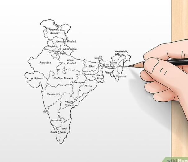
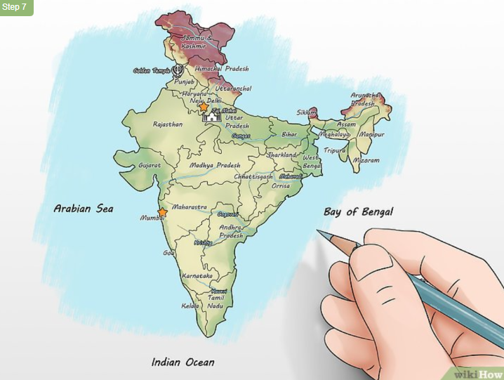
2.1 Draw the States and Union Territories
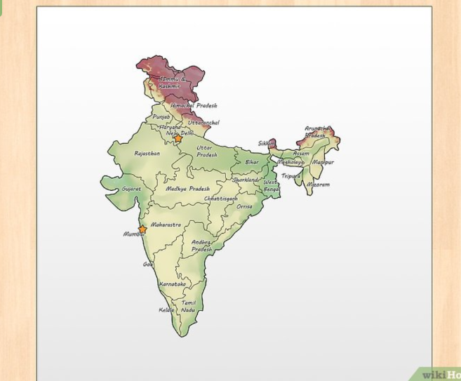
- India’s 28 states and 8 union territories have distinct shapes. Use a reference map to sketch their borders.
- Start lightly with a pencil to outline states like Rajasthan in the west, Uttar Pradesh in the north, Tamil Nadu in the south, and so on.
Tip: Start with larger states to establish proportions and then add smaller states and union territories for finer details.
2.2 Mark Major Cities
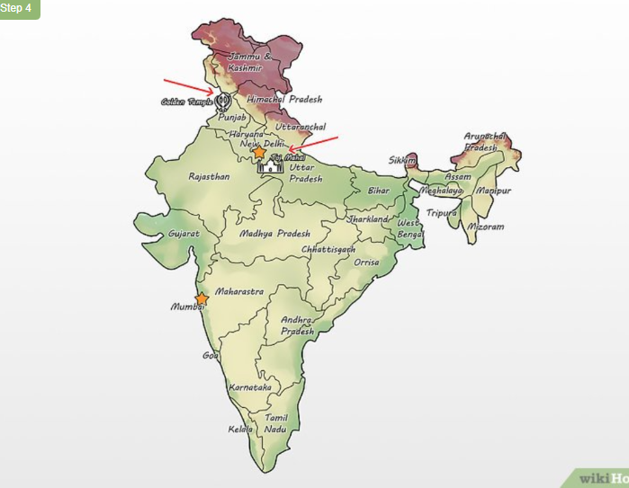
- Use dots or small symbols to mark prominent cities, such as:
- New Delhi (capital, in the north).
- Mumbai (west coast).
- Kolkata (east).
- Chennai and Bengaluru (south).
- Label these cities for clarity.
2.3 Illustrate Topographical Features
- Highlight major geographical features like:
- Himalayas in the north.
- Western and Eastern Ghats along the coasts.
- Thar Desert in the west.
- Use colors (e.g., dark purple for mountains, green for plains) to distinguish terrain.
2.4 Include Rivers and Landmarks
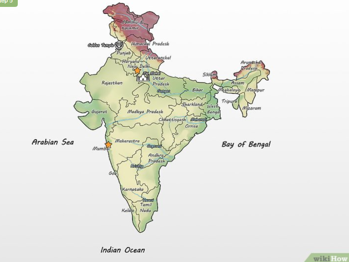
- Represent major rivers such as:
- Ganges (flowing across northern plains).
- Brahmaputra (northeast).
- Narmada and Godavari (central and southern India).
- Add famous landmarks like the Taj Mahal (Uttar Pradesh) and Golden Temple (Punjab).
2.5 Create a Key or Legend
- Include a legend to explain symbols:
- Dots for cities.
- Squiggly lines for rivers.
- Icons for landmarks.
- Place this key in a visible corner of the map.
2.6 Add Colors for Appeal
- Use distinct colors for states and territories for clarity.
- Highlight water bodies in blue and use earthy tones for deserts and mountains.
Step 3: Finalizing and Reviewing Your Map
3.1 Review for Accuracy
- Compare your map to a reference for correct proportions, city placements, and border shapes.
- Adjust any inconsistencies.
3.2 Erase Guidelines
- Carefully erase all guide lines (vertical, horizontal, and diagonal) to leave a clean map outline.
3.3 Optional: Add Decorative Elements
- Add a title at the top, such as “Map of India.”
- Decorate borders with patterns or include symbols of India’s culture.
Frequently Asked Questions (FAQs)
1. How can I ensure the proportions are accurate?
Use a reference map and measure sections with a ruler. Divide the map into grids if necessary to match proportions.
2. What tools do I need for this project?
You’ll need a pencil, eraser, ruler, reference map, and colored pencils or markers for adding details and coloring.
3. How can I draw a detailed topographical map?
After sketching the outline, add features like mountain ranges, rivers, and cities. Use colors to indicate altitudes—green for plains, purple for high mountains, etc.
4. What’s the best way to label cities and states?
Mark cities with small dots and label them with clear, legible text. Write state names within their borders or outside with connecting lines.
5. How do I make my map visually appealing?
Use vibrant colors to distinguish states and regions. Incorporate a neat legend, labels, and decorative borders to enhance visual clarity and aesthetics.
Conclusion
Drawing a map of India is both educational and enjoyable, offering insights into the country’s geography and cultural diversity. By following these steps, you can create an accurate, visually engaging map that highlights India’s states, cities, rivers, and landmarks. With practice and patience, you’ll master the art of map drawing, deepening your appreciation for this vibrant nation.

